IMPORTANT MESSAGE FROM THE EMERGENCY MANAGER
Hello,
Kure Beach Citizens,
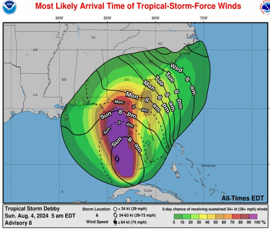
I hope this finds you safe and well. Below is the update from the National Weather Service at 8:00 am today regarding Tropical Storm Debby. Town preparations will continue through Monday and Tuesday, and you should be wrapping up inspecting your yard and securing any items to prevent impacting your property or your neighbors with the possibility of Tropical Storm winds Wednesday morning. Also please ensure that you have no debris that could be washed by the projected heavy rains into the stormwater system causing a local area backup with 8-12" of rain forecast for the area during this event, localized flooding is possible.
The Town has tested all generators and they are prepared in the event of a loss of power. Public Works, Fire and Police will respond to any issues and if you observe a stormwater backup all calls will be directed to public works at 910-458-5816. The answering service will be transferring calls after hours to on call phone in which we will respond to in the order they come in.
If you see downed power or cable lines treat them as energized and contact 911. Fire and Police will respond to evaluate safety issues and work to get the appropriate utility to clear them.
If the Town loses power please minimize your usage of water as with the Town full of residents and visitors, the lift station generators will be taxed to keep up. If you use temporary generators at your home ensure that there is proper ventilation generators (Carbon Monoxide poisoning) and chainsaws (following the storm) result in a significant number of deaths and injuries attributed to Hurricanes.
During the storm, please be careful and plan ahead for your trips. With these winds local conditions could become hazardous. Be extremely cautious of ponding water on roadways. Do not drive through standing water as you vehicle could become immobilized and then cause a traffic hazard impacting emergency services. Additionally a reminder that in the loss of power, or a non-functioning stop light all stop light intersections become 4 way stops.
Key points from the National Weather Service update:
- TS Debby is expected to strengthen into a hurricane prior to landfall in Florida Monday and will move very slowly near the Georgia/South Carolina coast through mid-week.
- The very slow progression of the storm will result in a very significant rainfall amounts across northeast South Carolina and southeast north Carolina. This amount of rainfall will likely result in life-threatening flash flooding. Otherwise, gusty winds and a few tornadoes are also possibly, but it is too early to predict some of the specific impacts with great detail at this time given the uncertainty in the track by mid-week.
- Please note that there is also a potential for heavy rainfall and some flooding associated with a weak front that will be stalled across the inland Carolinas this weekend. This rainfall will not be directly associated with Debby.
- All interests in the Carolinas and marine interest across the adjacent waters should prepare for this developing weather situation.
Respectfully,
David W. Heglar, PE
Emergency Manager, Town of Kure Beach